


Asia’s climate story is not only about hotter days on land. The ocean is accumulating heat too, and the World Meteorological Organization’s review of 2025 puts that change alongside floods, drought and the need for better warnings.
Published on 17 June 2026, the State of the Climate in Asia 2025 reports record ocean heat for the region. It says marine heatwaves affected more than 10 million square kilometres during July–September 2025. Those figures describe last year’s conditions; they are not a forecast for the coming season.
What the report shows—and what its scale means
WMO’s report announcement links the ocean findings with wider regional hazards. It records exceptional rainfall and flooding in parts of Southeast Asia and stresses the importance of timely warnings and coordinated action.
A regional report gives a broad view. It does not establish the temperature at every beach, the condition of every reef, or the causes of an individual flood. For a local decision, readers need the relevant location, dates and observations alongside the regional findings.
What counts as a marine heatwave?
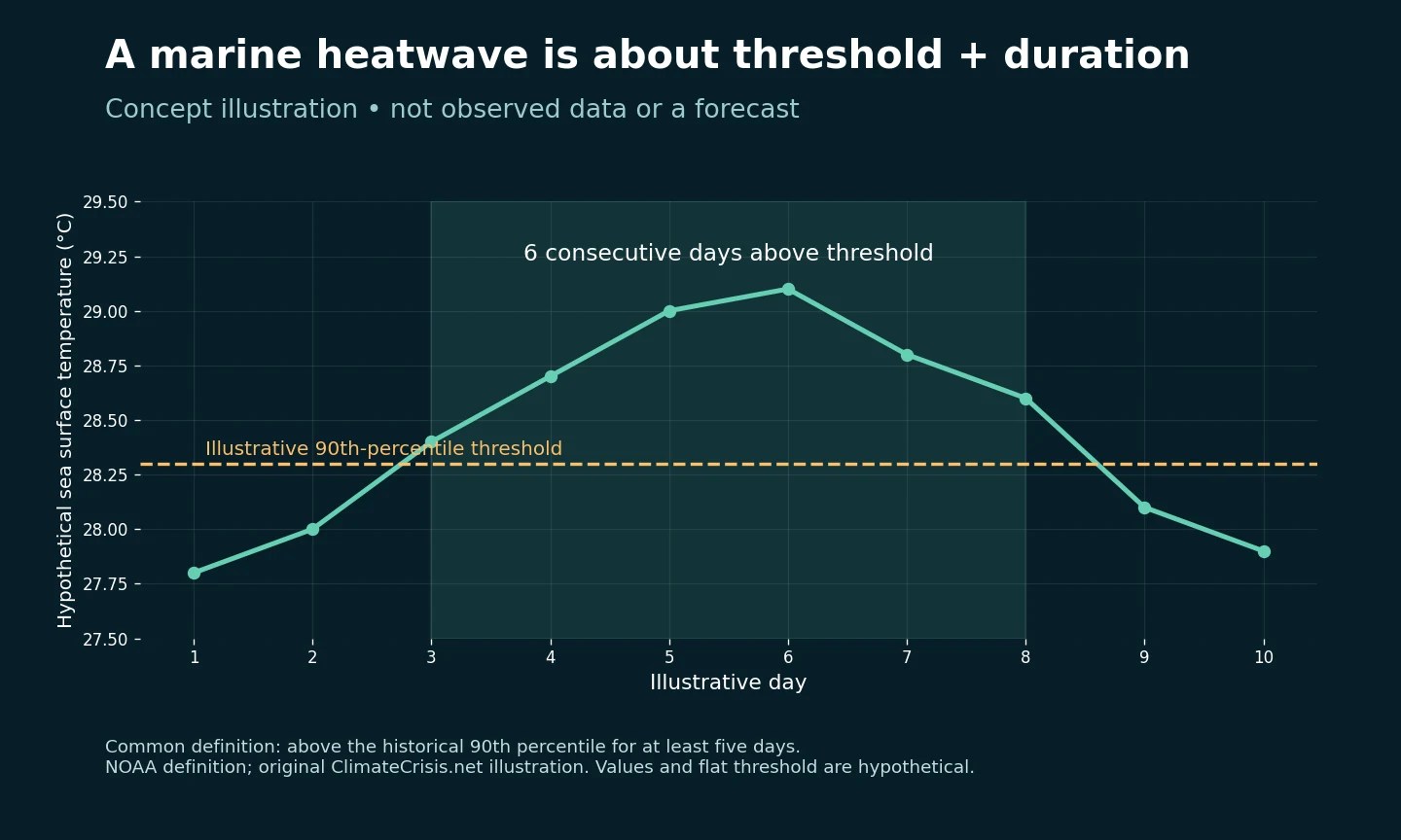
A marine heatwave is a sustained period of unusually warm ocean conditions relative to the local historical record. NOAA describes a commonly used definition in which temperatures exceed the historical 90th percentile for at least five consecutive days.
The threshold matters. A sea can be warm in an everyday sense without meeting that statistical definition. Conversely, unusually warm conditions in a normally cooler location can qualify. The illustration above uses hypothetical temperatures to show the duration test; it is not a map or a measurement of Asian waters.
Ocean heat content and a surface marine heatwave are also different descriptions. When comparing coverage, check which variable a chart measures rather than treating every ocean-temperature headline as interchangeable.
Why warnings need more than a forecast
The Early Warnings for All framework identifies four connected requirements: understanding disaster risk; observing and forecasting hazards; communicating warnings; and being prepared to respond.
That framework suggests practical questions for evaluating local readiness. Who receives an alert? Is the message understandable? Who is responsible for acting on it? What happens if the usual communication channel fails? A technically accurate forecast is only one part of that chain.
How Southeast Asian readers can use the findings
- Keep the date visible. A report published in 2026 can describe events in 2025. Do not present those events as happening today.
- Keep the geography visible. An Asia-wide result cannot be substituted for a national or coastal monitoring record.
- Ask what action follows. When a story discusses a warning, look for the responsible authority, the affected area and the recommended response.
These questions complement our guide to urban heat islands, where neighbourhood conditions matter, and our explanation of Southeast Asia’s cooling demand, which examines another consequence of heat.
The useful takeaway is to connect the regional evidence with specific local questions. Read the ocean findings as a signal to investigate exposure and preparedness, while using current local forecasts and official alerts for immediate decisions.